


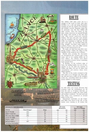
The 460km (286 mile) route ran in a triangle to
Page 22
If you've noticed an error in this article please click here to report it so we can fix it.
the north of Paris. Just after 04:00hrs on a cold and damp November morning we left the suburb of Le I3ourget and headed towards Bapaume along the Al autoroute over the first 142km (88 mile) section. After two hours on the dark, empty motorway we passed through the peage (toll control) to the first fuel stop, then turned south-west towards Amiens. The bars and cafés were already open for breakfast and the early mqrning traffic was beginning to build up. On the open road again, we travelled along the long, straight, tree-lined roads typical of northern France, then into hillier terrain than we had experienced so far.
We made our third fuel stop after completing another 134km (83 miles) in the outskirts of the medieval city of Rouen.
Shortly after crossing the city-centre we encountered the steepest part of the route, and on two snaking climbs out of river valleys, the vehicles were timed over measured sections before continuing hack towards Paris.
At Herblay, on the northern edge of Paris, the fuelling facility was out of commission so for the final two sections of 105km and 26km (65 and 16 miles) fuel consumption and journey times were added together.
The first of the trucks returned to the start point at Le Bourget just after midday and met heavy traffic on the outskirts of the city, something which was to affect all the vehicles to some degree.