


Way-finding in War-time
Page 22
Page 23
If you've noticed an error in this article please click here to report it so we can fix it.
Some Simple Notes on Map Reading Which Should be of Assistance to , Drivers and Prevent Lost Mileage as a Result of "Losing the Way
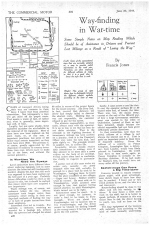
CIASES of transport drivers losing their way are common in these days; I know that from practical observation. Not infrequently a man will get miles off his proper route. That means a waste of fuel, of rubber and, what is, generally, more important still, of time..
Larely, but not quite wholly, these expensive mistakes are attributable to the removal of the signposts. Most of them have now been replaced on the main roads, or, at any rate, at important junctions, but some of the minor ways remain unmarked, as they have been since 1940. The position is, of course, greatly aggravated by the dispersion of industry to country areas. More than ever, drivers _have to make use of the lanes, and without the normal guidance..
In War-time We Need the Byways Local authorities have different ideas about replacing signposts and in some districts the lanes are still inadequately marked, despite the,fact that the work was supposed to have been carried out the best part of a year ago. Probably labour difficulties would be cited as the excuse for this, but it should be realized that minor roads have now acquired a new importance.
Waste mileage was, of course, not unknown before the war. Drivers sometimes took longer routes than necessary, either owing to their own slap-dash methods of finding the way or to lack of proptr instructions from their employers.
Sometimes that led to trouble. For example, a customer, receiving an account for a .haulage job, noticed that the operator had charged for about
50 miles in excess of the proper figure for the iound journey. The lorry had, in fact, covered that distance; the driver had simply failed to discover the shortest route. Holding that he was not responsible, the customer refused to pay for the excess.
The ultimate responsibility, in these cases, always rests with the operator. It is up to him to see that his men do not make mistakes. That is the principle in the Fighting Services; if unnecessary mileage has been covered on a journey, then it is the Transport Officer who takes the first kick, and quite rightly so. The principle should be applied, too, in civilian life.
Invariably, drivers should receive their instructions in writing, even if they amount to no more than a name written on the back of an envelope. Verbal orders often lead to confusion, due chiefly to vagaries in pronunciation.
A perfect case of this came under my notice only. recently, An Army despatch rider was told, verbally, to proceed to a place that he took to he Wardington. Arriving there, he found that the place constted of two villages —Upper and Lower. Neither yielded 'what he wanted. He next rode on to Wormleighton, which sounded near enough to him; that journey having proved abortive, he tried Warmington, which turned out to be right.
Instructions must be exact. It is not 'good enough, for instance, to order a load to be taken to Farnbtorough, There are about five Farnboroughs, not to mention one or two Farmboroughs, and the driver cannot be blamed for finding himself in the wrong county if he has not been given the full address. Lately, I came across a case like' that. It cost the operator perhaps 20 or 31) wasted miles and, of course, the time. There was, too, the classic story, current at the end of the 1914-18 war, of bow a large Government establishment was erected in the wilds of Oxfordshire, instead of Kent as had been intended, simply because the official responsible had not been given sufficiently precise directions.
In that connection, note that the postal address of a village is not always the nearest one to it. That is quite an important point in these days of dispersed industry. Given the address of a concern at Fenny Compton, Leamington Spa; a driver, say, from London, would very likely proceed to Lea.mington. He would then have to turn south again, as Fenny Compton is actually in the Banbury direction. If. he had made for Banbury first, he would have cut many miles off the journey.
Sketch-maps Can Prove a Big Time-saver Concerns located in remote country places might, with great advantage, issue sketch maps to show how they can be reached. I know one or two which already do so, and the idea is a real time-saver.
Route-finding shouldbe done in the office, and not left entirely to tar driver. " It may throw a little more work on the staff, but it is better to spend, perhaps, 10 minutes in this way rather than to risk the driver having to waste, say, half an hour on the road.
The map equipment of the business will, naturally, vary according to 'the kind of work normally undertaken.
To start with, every office should have a good map of the whole country, on a single sheet. It is much more convenient, when looking out lengthy routes, than having to refer to several sheets, or different pages in an atlas. Such.a map, however, has considerable limitations, and for getting further details one to a quarter-inch scale— four miles to orle inch—is the most satisfactory for •all-round use:••
Personally, I do not think the Ordnance Survey maps canbe bettered, although the " quarterinch " Bartholomew is excellent. Some drivers confider these maps confusing, as compared with ...the more simple styles, which show nothing beyond the lines of the roads. The greater detail of the Ordnance methods is often of value in way-finding, and it takes but little time to master.
The Needs of the Local Operator If the operator be concerned with only local work, however, then his requirements are different. He will find " half-inch " maps most suitable, and of these I think that Bartholomew's are definitely the best, Should he be mainly engaged on farm haulage, he would, indeed, be well advised to have in the office a "one-inch " map covering hia whole area; probably that will mean cutting and mounting several different sheets. As I know from experience, such a map is ideal if one has constantly to be hunting °tit the best way to remote farms.
• A map-measurer is most useful and good ones used to cost about 4s. before • the war. In its absence, distances can be measured with a pair of simple dividers or by laying out cotton or • wire along the route, or even a match-stick. Any of these methods can give reasonably accurate results. Whilst routes should be worked out in the office, maps should be available to drivers, whenever they. are likely to need them. They cost little, and would quickly be paid for in time saved on journeys, The operator, too, should see that the crews of , all vehicles can read maps; this is another feature in which civilian transport
might well follow the practice of the Services: Not only drivers, but their
mates should understand elementary map-reading, as on the road it is more convenient for the latter to act as " navigators."
No doubt most of those drivers who are readers of " The Commercial Motor" already 'understand maps, but there may be some who do not, owing to the fact that their journeys have been mostly of a routine character, for which maps have been unnecessary. To them, possibly, a few notes on the subject may be useful.
For a start, remember that any good map is more than a mere diagram of the road network. It is, on the con trary, a picture of the country it covers; a description of it, written in a system of • conventional signs, In large-scale maps, that description is extremely detailed.
Every normal inap is laid out from north to south, north being at the top of the sheet. The first thing to do is to ascertain the scale; that is, the actual road distance represented by a measurement of one inch on the map itself, The scale will usually be shown on the bottom margin, where also will be given an explanation of the conventional signs employed on the particular sheet. These signs vary somewhat on different maps, so that whatever map it may be the diagrams should be studied. The interpretation of the symbols 'is almost entirely a matter of common sense. A road that is shown as a broad line of colour is, as might be expected, a first-class road; a narrower line means a lesser road, and so on. Getting into the lanes, an uncoloured route, shown between broken lines, indicates an unfenced road, which will most likely be gated.
The usefulness of the other signs is often considerable. 'You may see from the map, for instance, that you are due to take the fourth turning on the left. Just possibly there may be confusion about that as, for instance, a carriage drive that you mistake fo,r a turning, or a new service road may have been made since the map was printed. If you note that, at the turning you want, there should be a large wood on the right, and that a church spire is visible over to the left, then you have the point nicely fixed.
Contouring is Simple to Understand
Contours—the height of the ground, that is—are shown very simply in colours, on the " quarter-inch " and " half-inch " maps. If your route leads over a brown patch, then you know there is a hill in the way. On the "one-inch " maps, contours are shown in much greater detail, bya system of lines. For some reason, contouring seems to puzzle many drivers, but it is simple enough to understand once the basic principle is grasped.
From the transport driver's point of view, there is really not much more to be said abOut: map-reading. Those who have a taste for it, however, can study the subject much further, and they are likely to, find it most fascinating.