


London permiti are "justifiable'i
Page 26
If you've noticed an error in this article please click here to report it so we can fix it.
THE GREENWICH/ Lewisham Freight Study was carried out and financed chiefly by the Greater London Council and the Transport and Road Research Laboratory, because both had a common interest in obtaining a clear understanding of the working of the freight transport system in a sample area of London.
The main GLC use for obtaining the data was to clarify the benefits and disadvantages of various policy options on which the council wished to reach decisions. The options included the control of goods vehicle movement by means of local or area restrictions, lorry routeing and the development of initiatives in the fields of a land use policy, a goods distribution policy and the use of rail and perhaps water transport.
The main TRRL requirement was for a data base to complement information being obtained for a "free standing" inland town, eg Swindon, and a port town, eg Hull, for use with assessing the effects of various types of lorry controls.
The area selected comprised 37sqkm (14.3sqmiles) in an area with a resident population of 207,000 and comprises about one-half of each of the London boroughs of Greenwich and Lewisham. It also contains a wide variety of manned use as well as the serious environmental and traffic problems common in Inner London.
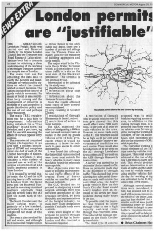
It is crossed by several major roads: the A2 and the A20 carrying heavy traffic volumes to London from the Kent ports, and the Blackwall Tunnel and its motorway-standard southern approach road (Al2M) which links the A2 with the north bank of the Thames.
The South Circular road, the major orbital route, is generally of a low standard, particularly to the west, and is congested for most of the daytime.
The area is also serviced by rail and water, and although the Continental Freight Depot at Hither Green is the only public rail depot, there are a number of private rail sidings near the Thames. These are mainly used for the transport of building aggregates and scrap metals.
The major wharf is the Victoria Deep Water Terminal which accommodates container traffic at a site on the west side of the Blackwall peninsular. This terminal is not serviced by rail.
Information to be collected by the study was: classified traffic flows, information about cost value routes, 1131 information about the business firms involved.
From the results obtained three types of lorry control were considered: El lorry routeing in Greater London, E restrictions of through movements in Inner London, [1] restrictions of access to Inner London.
The GLC examined the effects of designating a 680km road network on main roads as routes to be used by goods vehicles over 16 tons gvw, except where it would be necessary to leave the network to gain access to other destinations.
It was found that although the theoretical routes selected were those most suitable for heavy vehicles, in many cases the public found the proposals unacceptable.
Most objections were because of possible environmental and traffic effects of increased flows of heavy vehicles on specified parts of the road network.
The GLC decided not to proceed in designating a road network, although there was sufficient acceptance of the proposals involved, by both the public and representatives of the freight industry, to make lorry route designation possible if suitable roads were available.
Views were sought of the proposal to restrict through movements by hgv in Inner London and this received a favourable response.
11■1
A restriction of through trips by goods vehicles over 16 tons gvw showed that this would affect some 7,000 daily trips, 11 per cent of all trips by such vehicles in the area. However on some roads, such as the Al, the reduction could be as high as 60 per cent and would materially improve environmental conditions on such routes. There would also be reductions of 40 per cent on the A21 through Lewisham town centre and 17 per cent on the A206 through Greenwich town centre.
A survey was carried out to determine the increased traffic flows on perimeter roads due to the diversion of through traffic. This showed that even allowing for substantial diversion to roads well outside the controlled area, the heavy goods vehicle flow on the South Circular Road would nearly double, with an increase of 65 lorries per hour predicted during many hours of the day.
To provide relief, the proposal was revised to allow through trips to use a high capacity east-west route through the controlled area. This reduced the increase predicted on the South Circular by two-thirds.
The third type of control proposed was to restri vehicles requiring access to area, in addition to tho making through trips. It w proposed that there were ba on vehicles over 24 tons gl either during the working di 7am-6pm, or for the entire hours, with exemption ava able on the payment of £30 vehicle per day.
The restricted working d would eliminate all the 14,7 trips made by vehicles over tons gvw. This relief would achieved at the cost of div ting 7,300 trips to night opei tion. This would produce serious deterioration in no] levels at night and the addit: nal cost to vehicle operatc using smaller vehicles duni the day for working at nig was estimated to be £1.70 r vehicle trip (1976 prices).
Although several permui tions were considered, t GLC has decided not to pi ceed with access controls ON the whole of the Inner Lond area but has decided that t smatter central area justifi restricting entry by vehicl over 40 feet in length to pern holders. Implementation this proposal will be delayed allow operators to adjust th, operation.
• Brian Chalmers-Hut