


AUTOMAP
Page 46
If you've noticed an error in this article please click here to report it so we can fix it.
Fed up with tedious map reading and traffic jams? A new in-cab navigation system could be the answer to your prayers.
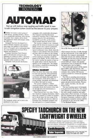
• Within two years a select group of 1,000 drivers, including hauliers, will enjoy a considerable advantage when driving in London: their vehicles will be fitted with equipment which will navigate within the M25 ring.
Autoguide has been developed by a team of British companies and organisations under the guidance of the Department of Transport and is undergoing trials on a very limited basis between Westminster and Heathrow.
Transport Secretary Paul Charmon plans to develop the system for pilot operation in London by 1990/1, and hopes that a full commercial system could be in operation within London by 1992.
Autoguide could provide distribution companies with considerable advantages. The Transport and Road Research Laboratory estimates that it could reduce journey times by 12% and distances travelled by up to 6%, as the system directs people along the fastest route.
The system is simple to use, communicating with the driver by means of a small display screen and a speech synthesiser. Each manoeuvre is announced on the speech synthesiser twice; firstly when the vehicle is some distance from the junction, and then when it is almost at the turning.
The driver can ensure that he takes the correct turning by checking a small bar graph on the display. As the vehicle nears the correct turning the number of bars on the graph reduce until the final bar disappears at the turning point. The display also includes a small arrow indicating the direction of the next turn.
SMALL HANDSET
When the driver first enters the vehicle he types the postcode of his destination on a small handset. Autoguide's speech synthesiser and display then guide him to that destination. If the driver makes a wrong turning, Autoguide will automatically re-direct him back on course.
The system comprises a vehiclemounted computer and a compass which continually checks the location of the vehicle through infra-red transmissions to small roadside beacons.
These beacons have two roles. Firstly, they broadcast mapping information, which allows the computer to confirm its position and to decide upon the next stage of the journey. Secondly, the beacons collect information from Autoguide-equipped vehicles and send it to a central computer which monitors the flow of traffic throughout the road network. If the traffic flow is disrupted, the computer automatically alerts the beacons and vehicles fitted with Autoguide are led away from the hold-up.
Autoguide equipment is likely to cost around .£250 per vehicle with monthly transmission costs of around 225, though the launch price may be higher.
The London pilot project will be operating in 1990/1 with 300 beacons. The Transport and Road Research Laboratory estimates that a further 600 beacons would be needed for commercial operation in London.
The DTp is consulting interested parties and plans to invite bids from groups to build the pilot project. Interested companies already involved include, Plessey, GEC, Logica, the RAC, the AA, and Rover Group.
The most exciting aspect of Autoguide is its potential for the future. The system uses Siemens technology and is compatible with a similar navigation unit undergoing trials in West Germany. It is hoped that the standard will be agreed among all European Community countries so that a pan-European navigation system could be in operation by the end of the 1990s. LI by Richard Scrase