 1
1 2
2 3
3 4
4 5
5 6
6 7
7 8
8 9
9 10
10 11
11 12
12 13
13 14
14 15
15 16
16 17
17 18
18 19
19 20
20 21
21 22
22 23
23 24
24 25
25 26
26 27
27 28
28 29
29 30
30 31
31 32
32 33
33 34
34 35
35 36
36 37
37 38
38 39
39 40
40 41
41 42
42 43
43 44
44 45
45 46
46 47
47 48
48 49
49 50
50 51
51 52
52 53
53 54
54 55
55 56
56 57
57 58
58 59
59 60
60 61
61 62
62 63
63 64
64 65
65 66
66 67
67 68
68 69
69 70
70 71
71 72
72 73
73 74
74 75
75 76
76 77
77 78
78 79
79 80
80 81
81 82
82 83
83 84
84 85
85 86
86 87
87 88
88 89
89 90
90 91
91 92
92 93
93 94
94 95
95 96
96 97
97 98
98 99
99 100
100 101
101 102
102 103
103 104
104 105
105 106
106 107
107 108
108 109
109 110
110 111
111 112
112 113
113 114
114 115
115 116
116 117
117 118
118 119
119 120
120 121
121 122
122 123
123 124
124 125
125 126
126 127
127 128
128 129
129 130
130 131
131 132
132 133
133 134
134 135
135 136
136 137
137 138
138 139
139 140
140 141
141 142
142 143
143 144
144 145
145 146
146 147
147 148
148 149
149 150
150 151
151 152
152 153
153 154
154 155
155 156
156 157
157 158
158 159
159 160
160 161
161 162
162 163
163 164
164 165
165 166
166 167
167 168
168 169
169 170
170 171
171 172
172 173
173 174
174 175
175 176
176 177
177 178
178 179
179 180
180 181
181 182
182 183
183 184
184 185
185 186
186 187
187 188
188 189
189 190
190 191
191 192
192 193
193 194
194 195
195 196
196 197
197 198
198 199
199 200
200 201
201 202
202 203
203 204
204 205
205 206
206 207
207 208
208 209
209 210
210 211
211 212
212 213
213 214
214 215
215 216
216 The road to nowhere?
Page 34
Page 35
If you've noticed an error in this article please click here to report it so we can fix it.
Satellite navigation systems might seem like the ideal solution for vehicles making journeys to lots of different sites. But is the current technology up to the job for LGVs? Dylan Gray and Roanna Avison investigate.
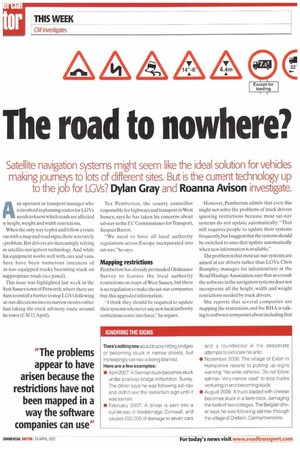
Afly operator or transport manager who is involved in planning routes for LGVs needs to know which roads are affected )3/ height, weight and width restrictions.
When the only way to plot and follow a route vas with a map and road signs, there was rarely 1 problem. But drivers are increasingly relying rn satellite-navigation technology. And while his equipment works well with cars and vans, here have been numerous instances of at-nay-equipped trucks becoming stuck on nappropriate roads (see panel).
This issue was highlighted last week in the Vest Sussex town of Petworth,where there are )1ans to install a harrier to stop LGVs following at-nay directions into its narrow streets rather han taking the truck advisory route around he town (CM 12 April). Tex Pemberton, the county councillor responsible for highways and transport in West Sussex, says he has taken his concerns about sat-nay to the EC Commissioner for Transport, Jacques Barrot.
"We need to have all local authority regulations across Europe incorporated into sat-nav," he says.
Mapping restrictions
Pemberton has already persuaded Ordinance Survey to feature the local authority restrictions on maps of West Sussex, but there is no regulation to make the sat-nay companies buy this upgraded information.
"I think they should be required to update their systems whenever any new local authority restrictions come into force," he argues. However. Pemberton admits that even this might not solve the problems of truck drivers ignoring restrictions because most sat-nay systems do not update automatically: That still requires people to update their systems frequently, but Isuggest that the systems should be switched to ones that update automatically when new information is available."
The problem is that most sat-nay systems are aimed at car drivers rather than LGVs. Chris Ram pley, manager for infrastructure at the Road Haulage Association,says that as a result the software in the navigation systems does not incorporate all the height, width and weight restrictions needed by truck drivers.
She reports that several companies are mapping the restrictions and the RHA is talking to software companies about including that information once it is available: The aim is to have that information available for sale as an LGV sat-nay package."
But she warns that in the meantime drivers who use sat-nay and do not pay attention to the signs will continue to fall foul of restrictions.
Sat-nay systems
Despite the fact that most sat-nay systems are not designed with LGVs in mind, some professional drivers appear to rely totally on this technology, rather than using it in conjunction with maps and road signs.
Don Armour, manager of fleet information at the Freight Transport Association, says: "There are lots of experienced drivers out there who, when given a sat-nay device, find all their experience and knowledge goes out of the window so they don't pay attention to the signs."
The problems appear to have arisen because the restrictions have not been mapped in away the software companies can use; but things are changing on this front.
Access to D6vc-r Eirty on defivery point destination ;impossible selection
Aspokesman for Ordinance Survey explains that the company began mapping restrictions as part of its Integrated Transport Network Layer last October and now has data on thousands of road restrictions across the UK.
He adds that OS decided to look at this because of the number of problems with LGVs and emergency services vehicles being directed down inappropriate roads.
"While we often provide mapping for satnay systems, systems, it can take a while for the process to trickle through," the spokesman says." Even when [the software companies] update their software, it relies on the user downloading the latest version."
A spokesperson for the EC was not available for comment as CM went to press. •