 1
1 2
2 3
3 4
4 5
5 6
6 7
7 8
8 9
9 10
10 11
11 12
12 13
13 14
14 15
15 16
16 17
17 18
18 19
19 20
20 21
21 22
22 23
23 24
24 25
25 26
26 27
27 28
28 29
29 30
30 31
31 32
32 33
33 34
34 35
35 36
36 37
37 38
38 39
39 40
40 41
41 42
42 43
43 44
44 45
45 46
46 47
47 48
48 49
49 50
50 51
51 52
52 53
53 54
54 55
55 56
56 57
57 58
58 59
59 60
60 61
61 62
62 63
63 64
64 65
65 66
66 67
67 68
68 69
69 70
70 71
71 72
72 73
73 74
74 75
75 76
76 77
77 78
78 79
79 80
80 81
81 82
82 83
83 84
84 85
85 86
86 87
87 88
88 89
89 90
90 91
91 92
92 93
93 94
94 95
95 96
96 97
97 98
98 99
99 100
100 101
101 102
102 103
103 104
104 105
105 106
106 107
107 108
108 109
109 110
110 111
111 112
112 113
113 114
114 115
115 116
116 117
117 118
118 119
119 120
120 121
121 122
122 123
123 124
124 125
125 126
126 127
127 128
128 129
129 130
130 131
131 132
132 133
133 134
134 135
135 136
136 137
137 138
138 139
139 140
140 141
141 142
142 143
143 144
144 145
145 146
146 147
147 148
148 149
149 150
150 151
151 152
152 153
153 154
154 155
155 156
156 157
157 158
158 159
159 160
160 161
161 162
162 163
163 164
164 165
165 166
166 167
167 168
168 169
169 170
170 171
171 172
172 173
173 174
174 175
175 176
176 177
177 178
178 179
179 180
180 181
181 182
182 183
183 184
184 185
185 186
186 187
187 188
188 189
189 190
190 191
191 192
192 SHOWING THE WAY
Page 59
If you've noticed an error in this article please click here to report it so we can fix it.
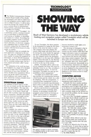
Bosch of West Germany has developed a revolutionary vehicle tracking and navigation system called Travelpilot which will be launched in Europe next month.
• The Mobile Communications Division of Robert Bosch GmbH of West Berlin has developed a new kind of vehicle location and navigation system which is accurate to within 10 meters. It will be introduced into Europe this summer and will pose a serious threat to infrastructurebased systems, particularly those relying on satellites for tracking.
The system is called "Travelpilot". It's a stand-alone system, meaning it doesn't rely on such things as induction loops, road beacons or satellites, to determine the location of a vehicle. Everything the Travelpilot computer needs is on-board, including wheel sensors to monitor distances and turns, an electronic compass, and a digitalized map to compare the information coming from the sensors and compass with the known layout of a city, region, or country.
The digitalized maps are probably the most impressive component in the system. The maps are contained on compact discs capable of storing 550 megabytes of information, or about 200,000 document pages. The maps were not transferred to disc by scanning existing maps, but by a more arduous procedure called "vector graphics".
The culmination of the work has been the installation on a single CD of detailed maps of 70 major West German cities (populations of more than 100,000), as well as 20,000 towns (populations 500 or more) and all the nation's motorways, federal highways and country roads. In short, Bosch has created a detailed street map of Germany on a CD.
PEDESTRIAN ZONES
The definition of these maps Is so fine that one can clearly see the thin strip of a major city thoroughfare. The maps also show pedestrian zones, airports and railway stations. In the future, Bosch will also be able to produce maps that indicate hotels, restaurants, churches and castles, giving an electronic travel-guide service.
Every street in a particular city is stored on the disc, but to avoid confusion while driving, smaller streets are only shown when the scale of the map is reduced. There are nine scales which can be selected manually, ranging in area from 200m to 50Iun.
Once engaged, the vehicle's current location is constantly shown as a blinking marker in the middle of the screen installed on the dash. As the vehicle begins to move, the streets on the map scroll past the marker giving a continuous representation of your progress. When the vehicle turns, the map immediately pivots around so that the driver's perspective is constantly maintained. "With this system you can never get lost," says Frank Breitsprecher, director of the Bosch Automotive press department. "You always have your exact location, destination, and the streets around you." To use Travelpilot, the driver punches in the destination by typing the first three letters of the street he wants to reach. The computer menu then displays the streets which begin with those letters and by moving the cursor beside the appropriate street, and pushing the execute button, the computer knows the destination and indicates it on the map with a blinking marker. From that point on, the direction of the destination is always indicated with an arrow at the top of the screen.
Initially, Travelpilot will be sold to rental car companies and those who travel to unfamiliar towns by car. But, according to Bosch information sheets, "it won't be long before Travelpilot can open up new possibilities in fleet management."
Travelpilot can be fitted with a serial data interface for communication between a fixed location and the vehicle via a cellular telephone. With this arrangement, "a customized fleet management system is created that can transmit map information back to base so that you can see what the driver is seeing," explains Breitsprecher.
Bosch is also involved in a partnership with another German technology giant, Siemens, in developing a location and navigation system known in Germany as "LISB" and in London as "Autoguide". This system is based on a network of beacons attached to traffic lights at intersections around a city.
The advantage of Autoguide is that in addition to location and navigation, the system can also monitor traffic flows and suggest alternative routes to avoid jams.
The system uses infared communications between the beacons and vehicles and a large central computer. Once the driver gives the destination to the computer, Autoguide takes over. Every time a beacon is encountered, theoretically at every intersection, instructions are relayed to the driver through voice commands and an arrow displayed on the screen on how to reach the destination. There is no map displayed on the screen on how to reach the destination.
COMPUTER ADVICE
Drivers could ignore the computer's advice, of course, but then the traffic management goal would be lost.
Autoguide also faces another problem. The cost of the equipment is high, and participation must be high if the system is to be effective in monitoring traffic flows. Bosch believes rental of the equipment with a monthly charge for the service is a way around this problem, but the concept has yet to be tested.
The cost of the Travelguide equipment is also high. Bosch officials would not confirm the price, but an educated guess of $4,000 (2,400) or more was offered and not dismissed. However, Bosch believes the system will compete well against its satellite counterparts, particularly in Europe. "We think that vehicle satellite systems will not really be feasible for some time," says Bosch, "100 metres accuracy might be alright for ships and planes, but is probably not precise enough for the road."
Travelpilot will be offered to the German motoring public next month and in other European countries later this year or in early 1990.
It will not be offered in the US for the forseeable future. It seems that as hard as it is to make digitalized maps of Germany or England, it's still easier than producing one for a country like the US. LI by John Parker.