 1
1 2
2 3
3 4
4 5
5 6
6 7
7 8
8 9
9 10
10 11
11 12
12 13
13 14
14 15
15 16
16 17
17 18
18 19
19 20
20 21
21 22
22 23
23 24
24 25
25 26
26 27
27 28
28 29
29 30
30 31
31 32
32 33
33 34
34 35
35 36
36 37
37 38
38 39
39 40
40 41
41 42
42 43
43 44
44 45
45 46
46 47
47 48
48 49
49 50
50 51
51 52
52 53
53 54
54 55
55 56
56 57
57 58
58 59
59 60
60 61
61 62
62 63
63 64
64 65
65 66
66 67
67 68
68 69
69 70
70 71
71 72
72 73
73 74
74 75
75 76
76 77
77 78
78 79
79 80
80 81
81 82
82 83
83 84
84 85
85 86
86 87
87 88
88 89
89 90
90 91
91 92
92 93
93 94
94 95
95 96
96 97
97 98
98 99
99 100
100 101
101 102
102 103
103 104
104 105
105 106
106 107
107 108
108 109
109 110
110 111
111 112
112 113
113 114
114 115
115 116
116 117
117 118
118 119
119 120
120 121
121 122
122 123
123 124
124 125
125 126
126 127
127 128
128 129
129 130
130 131
131 132
132 133
133 134
134 135
135 136
136 137
137 138
138 139
139 140
140 141
141 142
142 143
143 144
144 145
145 146
146 147
147 148
148 149
149 150
150 151
151 152
152 153
153 154
154 155
155 156
156 157
157 158
158 159
159 160
160 161
161 162
162 163
163 164
164 165
165 166
166 167
167 168
168 169
169 170
170 171
171 172
172 173
173 174
174 175
175 176
176 177
177 178
178 179
179 180
180 181
181 182
182 183
183 184
184 185
185 186
186 187
187 188
188 189
189 190
190 191
191 192
192 193
193 194
194 195
195 196
196 197
197 198
198 199
199 200
200 WAY TO GO?
Page 51
Page 52
Page 53
If you've noticed an error in this article please click here to report it so we can fix it.
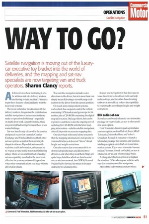
Satellite navigation is moving out of the luxury car executive toy bracket into the world of deliveries, and the mapping and sat-nay specialists are now targeting van and truck
operators. Sharon Clancy reports.
A11 drivers know how frustrating it is to be within a mile of a delivery address and having to take another 15 minutes to get there because of unfamiliarity with the local road systems.
The more unfamiliar the driver is with the delivery address,the greater the contribution satellite navigation, or sat-nay, can in theory make to operational efficiency — especially on multi-drop work.Apart from time, there are potential fuel savings because there is less wasted mileage.
Sat-nay has already taken off in the courier and parcels sector, for example. Courier Exchange and Wireless Delivered both offer sat-nay options as part of their on-line job dispatch software. If you link sat-nay with real-time traffic information, drivers can be re-routed around traffic hotspots, minimising delays.There are several methods of adding sat-nay capability to vehicles: the most costeffective for your operation will depend on what other communications you need with the driver and vehicle. True satellite navigation includes voice directions to the driver, but at its most basic can simply mean delivering a viewable map or directions to the driver from his current position.
On stand-alone independent systems, each vehicle has a separate unit in the vehicle containing UPS modem and gyroscope for direction, plus a CD-ROM containing the digital map information. On larger fleets, this can be expensive, and there is also the ongoing cost of updating the CD-ROM with the latest mapping information—reliable satellite navigation, after all, depends on accurate mapping data.
One drawback with stand-alone systems is that the mapping information is not specific to vans and trucks, so it does not "know" about height and weight restrictions.
One alternative that overcomes this is to download specific maps and directions to drivers as and when they need them. Maps are quite large data files, which are hard to send over a wireless network,but GPRS (General Packet Radio Service) has made it cheaper and faster to send large files. It is not true navigation in that there are no voice directions to the driver, but it can help reduce delays, and the office-based routing software is more likely to have the capability to route trucks according to height and weight restrictions.
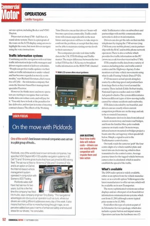
DIN radio sat-nay
If you have on-board telemetry or a telematics package on your vehicle, sat-nay is often available as an option.
Ford Telematics Services package includes a sat-nay option, as does Daf-tel, Iveco, MAN Telematics, Mercedes-Benz and Volvo's Dynafleet. Renault is expected to launch a telematics package this autumn, and Scania is trialling an option on its FAS on-board information system. If you use a telematics bureau such as Fleetstar. Isotrak or Orchid, sat-nay is offered on an 'as-and-when needed' basis.
A cheap and effective option is to replace the standard DIN radio in your vehicles with one that combines satellite navigation.
Most of the radio manufacturers offer a sat-nay option, including Becker and VDO Dayton.
Prices start at about £700— half that of a stand-alone system.There is a pictogram of the route on the LCD display, using arrows to highlight the route, hut most drivers navigate using the voice instructions.
Traffic information systems
Combining satellite navigation with real-time traffic information helps traffic managers and drivers regain control of delivery schedules. "People can get free traffic updates via their radio, so traffic information is under-valued and has become regarded as merely a commodity," says Richard Horsman, chief executive of Cybit — the telematics company that owns the Internet-based fleet management specialist Fleetstar.
However, he thinks more and more operators are starting to recognise that real-time traffic data can reduce costs, and will pay for it. "You only have to look at the penalties for late deliveries, and not just in terms of meeting contract clauses.The effects of the Working Tune Directive mean that drivers' hours will become a precious commodity.Traffic conditions will remain unpredictable in the near future and operators will have to take steps to confront the problem, or accept that they may not be able to maintain existing service levels to their customers.
Two companies provide real-time traffic data in the UK: ITIS Holdings and Thfficmaster.The major difference between the two is that ITIS has the UK licence to broadcast traffic information on the RDS/TMC channel while Trafficmaster relies on subscribers and partnerships with mobile communications networks to deliver its information.
Drivers can also get the info on their mobile telephones by ringing the 1740 service (ring 1740 from your mobile phone),run in partnership with the RAC and mobile phone network operators.There is also a website which provides live traffic information on the PC (www.rac.co.uk/travelservices/raelive/1740).
ITIS compiles traffic data from a variety of sources, including police and traffic control centres and the Highways Agency. It also monitors real-time vehicle movements using what it calls Floating Vehicle Data (FVD).
FVD measures actual speeds along key routes by collecting speed and position fixes from large fleets as they travel around the country.These include Eddie Stobart trucks, National Express coaches and over 4,000 AA patrol vehicles.The system differentiates between different types of slow-moving traffic caused by volume accidents and roadworks.
ITIS data is decoded by on-board kit, and drivers can see exactly where current congestion problems are on the map, and ask to be re-routed if necessary.
Trafficmaster derives its data from infrared sensors on motorway and main road bridges, and from the familiar blue-pole roadside cameras on trunk roads. On motorways, infrared sensors mounted on bridges project a beam onto the carriageway; when speeds fall below 30mph, a signal is sent to the Trafficmaster control centre.
On trunk roads the cameras 'grab' the four centre digits of a vehicle number plate and turn it into an electronic tag, which is then transmitted to the control centre.Average journey times for the tagged vehicle between camera sites is calculated, which is used to establish the speed of the traffic.
What's available
The DIN radio option is widely available, either as an option from the vehicle manufacturer, or as a retrofit option. Volkswagen is the latest manufacturer to offer sat-nav,which will be available on its new Transporter.
The more sophisticated versions use colour displays and are often part of on-hoard driver information communications systems, which cost from £1.200 (although a more typical price seems to be f1,500).
Ford offers this type of system as part of its Telcmatics Services package, which also includes a panic button and impact sensor. Operators can lease the hardware on a 12 month contract, and can either access vehicle information via a website or create their own reports using dedicated software.
Iveco offers two versions of the Daily with satellite navigation. There is the Becker DIN radio with inclusive sat-nay, and the more sophisticated CompuDaily based on the Compaq Personal Digital Assistant (PDA). The PDA incorporates a telephone, barcode reader and on-board data collection unit as well as navigational information.
The new Vito will be the first Mercedes-Benz van with the option of the latest Command satellite navigation system.
M-B already offers an earlier version,EN2, in current Sprinters and Vitos and its heavy truck range, but Command is a multifunctional unit, offering on-board trip and driver display with communications, navigation and CD/radio functions.
All the information is displayed on the LCD monitor mounted in the centre console.The RDS/TMC function is integrated so routes can be updated in real-time to take account of actual traffic conditions.
On heavy trucks, there seems to be less demand for real-time sat-nay, although the manufacturers are beginning to include it in option packages.
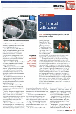
Volvo, for example, offers it as an option on Dynalleet, Iveco plans to include it on Stralis. Daf has added it to its Daf-Tel telematics service (operated in conjunction with Siemens VDO Trading) and Scania is trialling a live navigation option to its on-board Fleet Analysis System.
Trafficmaster's Smartnav combines traffic information and satellite navigation. Drivers interact with it directly over a standard mobile phone network, talking to a person at the Traf ficmaster call centre 'The route is calculated and transmitted back to the cab. It is stored on the in-cab device and the drivers receive voice directions.
Available as an option is Route Guard, which monitors traffic congestion, alerts drivers to problems and offers them the option of an alternative route to avoid delays.
A single Trafficmaster Smartnav system costs £499 plus installation.There's also an annual subscription charge of £120 (or £350 for four years).
The optional Safe Speed, which alerts drivers to speed cameras,costs16 a month, and Stolen Vehicle Location costs a a month.The MS5400 is the latest version of what Siemens VDO Trading claims is the UK's best-selling satellite navigation unit with map display The MS5400 retains CD-ROM mapping and a TMC option, but also incorporates a more powerful processor for faster route calculation and a cheaper 'pay-as-you-go' option called C-IQ.
Siemens states: "The key to cost-effective navigation lies in being able to provide customers with only the data they require." •