 1
1 2
2 3
3 4
4 5
5 6
6 7
7 8
8 9
9 10
10 11
11 12
12 13
13 14
14 15
15 16
16 17
17 18
18 19
19 20
20 21
21 22
22 23
23 24
24 25
25 26
26 27
27 28
28 29
29 30
30 31
31 32
32 33
33 34
34 35
35 36
36 37
37 38
38 39
39 40
40 41
41 42
42 43
43 44
44 45
45 46
46 47
47 48
48 49
49 50
50 51
51 52
52 53
53 54
54 55
55 56
56 57
57 58
58 59
59 60
60 61
61 62
62 63
63 64
64 65
65 66
66 67
67 68
68 69
69 70
70 71
71 72
72 73
73 74
74 75
75 76
76 77
77 78
78 79
79 80
80 81
81 82
82 83
83 84
84 85
85 86
86 87
87 88
88 89
89 90
90 91
91 92
92 93
93 94
94 95
95 96
96 97
97 98
98 99
99 100
100 101
101 102
102 103
103 104
104 105
105 106
106 107
107 108
108 109
109 110
110 111
111 112
112 113
113 114
114 115
115 116
116 117
117 118
118 119
119 120
120 121
121 122
122 123
123 124
124 125
125 126
126 127
127 128
128 129
129 130
130 131
131 132
132 133
133 134
134 135
135 136
136 137
137 138
138 139
139 140
140 141
141 142
142 143
143 144
144 145
145 146
146 147
147 148
148 149
149 150
150 151
151 152
152 153
153 154
154 155
155 156
156 157
157 158
158 159
159 160
160 161
161 162
162 163
163 164
164 165
165 166
166 167
167 168
168 169
169 170
170 171
171 172
172 173
173 174
174 175
175 176
176 177
177 178
178 179
179 180
180 181
181 182
182 183
183 184
184 185
185 186
186 187
187 188
188 189
189 190
190 191
191 192
192 193
193 194
194 195
195 196
196 197
197 198
198 199
199 200
200 201
201 202
202 ROUTE NG FOR FREE
Page 54
Page 55
Page 56
Page 57
If you've noticed an error in this article please click here to report it so we can fix it.
The best things in life are supposedly free... so how does free online routeing software compare with the kind of package you have to pay for? Robin Meczes finds out.
The rise of the internet has brought with it a new phenomenon— that of online software. No need to wait for your software to arrive.go through what may be a tricky installation process and then wonder if your computer is up to the job.All you need is a computer with an internet connection.
Not all software is suitable for this kind of remote access, but one type that is is routeing software, and there is no shortage of online routeing guidance to be found. So how does it really compare to the kind of package you have to pay for and install?
To find out. we tested four online packages. In each case we asked the software to work out two standard routes — one UK and one international — and benchmarked our results against the same routes generated by Microsoft MapPoint.one of the most functional paid-for packages around.
Our UK route began in Bournemouth, headed north to Birmingham. then east to Peterborough before returning south to our starting point. For our international route, we elected to set out from Commercial Motors home town of Sutton on a journey to Lyon, France, and then Brussels. Belgium, before once again returning to base.
The routes produced by our benchmark software,Microsoft MapPoint, were pretty much as we expected.The BournemouthBirmingham-Peterborough run was calculated as 473 miles over eight hours,17 minutes' driving time.That would mean an average speed of around 56mph.
MapPoint suggested our initial run from Bournemouth to Birmingham should go via the M27 and M3 up to the M25.in order to pick up the M40. Although this is far from the most direct route, the heavy dependence on motorways should, to Microsoft's mind at least, have made for the fastest journey.
The cross-country run to Peterborough sent us east on the M6 before picking up a series of A-roads, when the motorway ran out, in a more or less straight line to Peterborough.
For the run back home. MapPoint suggested picking up the Al (M) just south of Peterborough, staying on it until we hit the M25, then curving around to the west in order to return home along the M3/M27. The Sutton-Lyon-Brussels route came to a hefty 1207 miles, which MapPoint said would take us 17 hours and four minutes.Th at surprised us, because it meant an average speed of over 70mph. but then MapPoint's default setting is for an average speed of 75mph on motorways, which probably goes some way to explaining it.
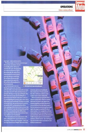
RAC The first of our four online competitors was the RAC. Its online routeing software loaded up straight away and invited us to enter our start point, destination and up to five stops in between.You also get to choose between the fastest and shortest routes, enter some basic ' preferences about motorway usage and toll roads and finally choose between two different map types —static and interactive.
We had a couple of obscure error messages during route calculation,but did eventually get the software to calculate the route. Strangely, this ran only from Peterborough to Boumemouth.We clicked on a button marked 'return journey' and were shown a route from Broad Street,Boumemouth (appearing on the map to be Broad Street,Birmingham) to, er,Bournernouth.
Several attempts later we finally got some sense out of the software with a route that took in all our stops and came out at 427 miles and nine hours,17 minutes' driving (average speed 46mph).The RAC uses an average speed of 60mph on motorways and 30mph on all other roads, so it's not surprising the journey time came out so different to our benchmark. Perhaps as a result of this, the RAC also preferred not to send us around the M25, opting instead (as all the other packages did in fact) to have us leave the M3 at Junction 9, take the A34 northbound for 60 miles or so and pick up the M40 at that point.Apart from that the route selected was very similar to our benchmark.
The international route came out at 1,256 miles, which the RAC said would take us a whopping 37 hours and 11 minutes —that's an average speed of] ust 34mph.This looked like nonsense, given our benchmark time of just over 17 hours,and all. the other software results to cornM on this route would confirm this.
When it worked properly the RAC software did produce what we wante , and wasn't too bad to use, apart from ' an annoying little problem whereby if you scroll down from the initial map to the text instructions below and then back again, the map is scrambled-We liked : some touches — for example the softwa ' can produce turn-by-turn maps for you if you want them, will warn you about known traffic hotspots and can even includes a database of RAC hotels— but with bugs as big and as bold as those we found, we can hardly recommend it.
hiaPPY
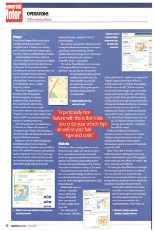
Next up was Mappy. It has a nice, clean interface and entering routes is very straightforward. It limits you to starting point destination and up to three stops in between, which was sufficient for our routes.
A particularly nice feature with this software is that it lets you enter your vehicle type, including motorcycles and trucks, as well as your fuel type and costs,then calculates your journey costs for you as you go. You also get to choose between express routes and routes without tolls, and there's even an option to avoid mountain passes — handy for heavy vehicles.
The route it suggested for our Bournemouth-Birmingham Peterborough run was almost identical to that chosen by the RAC and came to 441.25 miles, which it said would take us eight hours, three minutes (an average speed of 55mph). It even told us how much of the route would be by motorway, and duly calculated our fuel costs for us.
The European route was calculated as 1,216 miles, or 18 hours, 42 minutes of driving (average 65mph). On this journey, the software also calculated the toll costs of using the French motorways.
Mappy provides a wealth of additional information about points of interest, including hotels, restaurants and post offices in the UK, and Wi-Fi hotspots,cash machines and newsagents in France. For France only, you can also get an online update on traffic and weather conditions.And the maps even show where speed cameras crop up in mainland Europe — sadly, the UK isn't included in this.
The software was also the only one we were testing that allowed us to arrange our stops in a particular order or have the software optimise the order of stops for us.There is also an option to transfer your routes to a PocketPC device — a nice touch.
Overall, we found Mappy easy to use and well designed. We had a couple of minor quibbles one that the text instructions provided didn't include junction numbers for motorways; the other that the map initially provided was among the smallest of all the packages on test. But overall, definitely recommended.
Michelin
Michelin's online routeing software was an interesting mix. Again, you can specify up to three stops between your start and finish points and again, you can choose between the quickest and shortest routes, adding motorway and toll road preferences on top. You can also opt to avoid border crossings,if you want.
You get to choose your vehicle with this one.too, but unlike Mappy, the choice doesn't extend further than car, motorcycle and caravan.And we thought Michelin knew a fair bit about roads!
Michelin also came up with an even smaller onscreen map than Mappy. Thankfully there's an option to produce a bigger one if you want.
The Michelin UK taking eight hours, 11 minutes (average spe 54mph).Again, it diverted us off the M3 northbound on the A34, rather than sendin us all the way to the M25. On the way back down from Peterborough. it opted to send u west in order to pick up the Ml, rather than using the Al(M). It also provided a summa of toll costs, fuel costs and a total cost as well offering information about hotels, restauran tourist attractions and car parks at our finishing point. Sadly, no similar inforrnatio was on offer for other points on the journey Our Sutton-Lyon-Brussels route cameo at 1,197 miles, in 19 hours, 48 minutes (average speed 60mph)— roughly in line with the others.
We liked the Michelin offering for a number of reasons. For instance,it includes toll gates and speed cameras on its route instructions (though no speed camera information cropped up on our 438-mile hik around the UK).
There's also a link to weather and live traffic information, although the latter was only available in small regions (Birrningha north,south,eastwest, etc) so we couldn't g an overview for our whole trip.
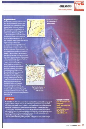
Our main gripe about Michelin's offering that moving around the maps is too difficult. You can only click on arrows at the map borders to move around, but these move yo pre-set distance, which isn't always ideal, wit no option to recentre it on a given point On the other hand the route instructions allow you to display miniature:• turn-by-turn maps for any individ turn without generating them for every last one as software like MapPoint tends to. Well worth a try.
MapPoint online
Since we were comparing online packages with Microsoft MapPoint,it seemed only appropriate to see how MapPoint would stack up against... MapPoint online.Yes, Microsoft appears to be pulling the rug from under its own feet by supplying a free online version of its mapping software.
This isn't really true because the online version is very simple indeed compared to any full-blown routeing package. It's also very simple indeed compared to the other online software reviewed here.
You can only enter a starting point and destination — no intermediate stops — so to recreate our more complex routes we had to treat each segment as a separate journey. And although there's an option to save routes to a PocketPC device, choose between quickest and shortest routes and select one of two map types, there's none of the extras of some others Having said that, it produced probably the clearest onscreen maps of all.
Our UK route came to 430 miles — in line with all the others. But the journey duration was a staggering six hours and 31 minutes — an average of 66mph and approaching two hours faster than the full-blown version of MapPoint (that's the full-blown version that's already suggesting an average motorway speed of 75mph).
Our trip to France and Belgium, at least, came out more sensibly at a total of 1,205 miles over 20 hours,48 minutes (average speed 58mph).
Overall, MapPoint online is fine for It' n. raight A to B journeys, providing a quick verview of routes and very clear maps. But 1 atch out for the unrealistic journey times that i 4an crop up. • CM VERDICT The main problem wrth all the online routeing software we tested is that you can't tweak the average speeds they apply to different road types as you can with full-blown packages.That means they'll assume the same average speed whether you're in a car, truck or space shuttle and since their speeds are inevitably based on cars, commercial vehicle operators with anything bigger than a 7.5 tonner needn't apply. On the other hand, leaving journey times to one side they DO still provide routeing instructions. And 0110, while none ot them has anything like the sophistication of a full-blown buy-and-install package, all of them {even the RAC offering when it was behaving itself) did come up with similar routes and turn-by-turn instructions that would generally get you from A to B efficiently.
They ain't sophisticated and they certainty ain't perfect, but hey, just what do you want for nothing?