


FORD NAVIGATION SYSTEM
Page 32
Page 33
If you've noticed an error in this article please click here to report it so we can fix it.
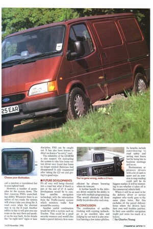
What have this Ford Transit and a cruise missile got in common? Answer: both are guided to their destinations by a group of US military satellites.
The Global Positioning System (GPS) is a group of 24 satellites originally set up to guide weaponry But as the satellite signals can be picked up by anyone with a receiver, a number of man• ufacturers Bosch, Philips and Alpine in particular—are using them for vehicle navigation purposes.
The theory is that once a vehicle has been located by the satellite, an on-board computer can use a map to direct it from point A to point B.
Unfortunately though, the US military built in an inaccuracy to foil unscrupulous users, and the satellites can only pinpoint a vehicle to within 100 metres. Pretty good admittedly, but not good enough if you're in a crowded city To overcome this and to give the exact vehicle location, a number of other components complete the navigation system. These include a CD-ROM database with a digitised map of the area; a computer; a compass; and wheel sensors.
The compass and wheel sensors combine to create a linear pattern of the vehicle's movement. The computer then overlays this pattern on to the roads within the 100 metre radius until a match is obtained. Once this happens the computer knows exactly where the vehicle is until it goes out of the mapped area (into a multi-storey car park, for example).
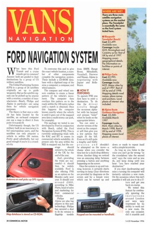
The package we tested is one developed by Ford in conjunction with Bosch, called the Ford Navigation System (FNS). This is currently undergoing trials with the RAC and BT to assess its commercial vehicle suitability. At present only the area within the M25 is mapped out, but the cov erage should extend to the whole of the UK by the end of the year.
And—providing the trials are successful—it should then be widely available. Ford is also offering FNS as an option on the Monde° early next year. It should cost around £800, according to Mike Platts, head of sales and marketing for Ford commercial vehicles.
Philips and Alpine are also big players in this new technology. Philips has secured a deal to fit its version to flagship models from BMW, Range Rover, Mitsubishi, Vauxhall, Daewoo and Nissan. Alpine is negotiating with Jaguar and RollsRoyce.
To operate FNS you first have to enter a destination. To do this the driver scrolls through the on-screen alphabet with his keypad and presses "enter" when he lands on the appropriate letters.
You can enter a shorter version of the street as the computer will then give you a few options that might fit the bill. Even so it's still quite a lengthy and fiddly process and shouldn't be attempted on the move—a shame when you consider the time lost for a multi-drop delivery driver. Another thing we noticed was an annoying delay between pressing a button and anything happening on the screen.
Once the system is up and running, however, it certainly starts earning its keep. Clear directions are provided by diagrams on the screen and by a female voice which can be turned up and
down or made to repeat itself with a simple keystroke.
As long as you listen to the voice you can't go far wrong "at the roundabout take the second exit," says the voice and so you do, and keep doing until you hear: you have reached your destination."
If you start daydreaming and miss a turning the computer will instantly calculate a new route. On the occasions where this isn't possible it will ask you to do a Uturn and get you back on course.
We tested this feature by continually ignoring the instructions around London and were very impressed by its ability to work out a new route. On only one occasion did it stumble and call a junction a roundabout but it soon righted itself.
However, a number of anomalies let the system down. The first concerns FNS's route-finding ability. Whenever there is an option of two roads the system will always take you along the A road—even when the shortest way is via the B road. Another oddity is that it will give you one route on the way there and another on the way back. As for details like "no right turn" signs or lane FNS can be caught out It has also been known to direct us down a "no entry" road. The reliability of the CD-ROM is also suspect On instructing the system to take him home our test driver once found that home no longer existed: Battersea had disappeared! It only reappeared after taking the CD out and giving it a good wipe.
• FUTURE DEVELOPMENTS It's all very well being directed into a road but what if there's a jam at the end of it? A useful development would be to com bine satellite navigation technology with the information from the Traffic-master system which monitors traffic flow around the country.
Another useful combination would be with a system such as Tracker. This could be a good security measure and would also make a parcel delivery firm more efficient by always knowing where its vans are.
A further benefit to the delivery driver would be the ability to cope with multiple programming. This would eliminate all those fiddly keystrokes after each stop.
The combination of satellite tracking with existing technology is an excellent idea and judging by our test it is also practical barring a few minor glitches. Its benefits include contributing to road safety and saving man hours lost by being late to business meetings and so on.
Businessmen or pleasure drivers with a bit of cash to spare and an aversion to map reading could well be its biggest market. It will be interesting to see whether it takes off in the commercial vehicle field.
Where it will be an asset is for the delivery driver or service engineer who rarely goes to the same place twice. But this excludes all the parcel delivery firms where the drivers have their own well trodden patches. In their case satellite navigation might just seem too much of a luxury.
0 by Charles Young