


IT'S GOO
Page 42
Page 43
If you've noticed an error in this article please click here to report it so we can fix it.
TO TALK
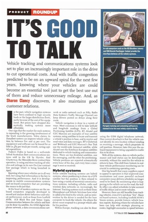
Vehicle tracking and communications systems look set to play an increasingly important role in the drive to cut operational costs. And with traffic congestion predicted to be on an upward spiral for the next few years, knowing where your vehicles are could become an essential tool just to get the best use out of them and reduce unnecessary mileage. And, as Sharon Clancy discovers, it also maintains good customer relations.
n the past, vehicle navigation systems have been confined to high security loads or the larger distribution fleets, partly because of the cost of the equipment. But prices have dropped dramatically, making systems more affordable.
One sign that the market for such systems is expanding is the growing involvement of the truck manufacturers. Volvo claims its Dynafleet system can improve vehicle utilisation by between five and 15 per cent. The equipment and software can be leased for as little as f85 per truck per month, saving capital expenditure.
Foden's Fodex is based on a well-established Australian fleet communications systems sold in the UK by Hyrolec. And Charterway, the Mercedes-Benz contract-hire operation, is using real-time tracking of vehicles and mileage in its new On-Line contract hire package which is being launched in April.
Knowing where your vehicles are is all very well, but using that information is the key to improving performance. And it is developments in mobile communications systems and on-board computers that are providing the means to do just that.
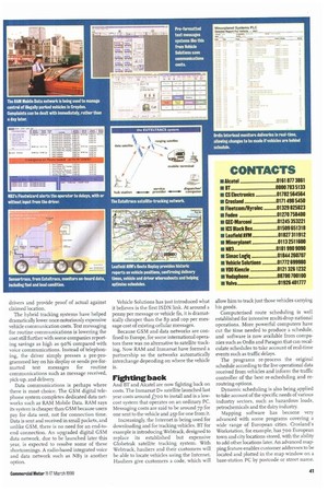
At the heart of modern systems are the onboard computers originally developed to record and analyse driver behaviour and vehicle performance, such as those from Leafield AVM, ICS Black Box and Simac Logiq. Communication between the vehide and base can be done via satellite, the GSM digital telephone network, a data communications net
work or radio network such as NB3. Radio Data System's Traffic Message Channel can keep drivers posted on delays along their route.
Vehicle navigation is done in a variety of ways. Most common is still to take latitude and longitude readings from a Global Positioning Satellite (CPS). BT, Alcatel and GEC Marconi are examples of true satellite systems, using satellites to locate and transmit a vehicle's position to base, and to receive and send voice and data messages. BT's Globetrak and Webtrack and GEC-Marconi's Star Trak use the world-wide Inmarsat satellite, while Alcatel uses the Euteltracs European satellites dedicated to vehicle tracking and communications. There are two Eutelstat satellites, one for messaging, and the other for positioning. Vehicle positions are reported automatically every hour of the day, and every time a message is sent or received.
Hybrid systems
Some satellite tracking systems are hybrid systems, where positioning is done via a G PS satellite but the position is then relayed to base using a variety of terrestrial communications systems, including cellular, radio and wireless data networks or, increasingly, the Internet. Tracking systems such as those from Minorplanet and Vehicle Solutions have what is called a live feed to the vehicle, and no intervention by the driver is needed for the base computer to track the vehicle. On others the driver must respond to a prompt which asks for his position.
Within Europe, tracking can also be done using the GSM digital telephone network. One current drawback is that the vehicle cannot identify its own location without sending or receiving a message, which pinpoints its cell position. However, later this year the onboard equipment is being upgraded to enable this to be done.
With all the systems, data on vehicle performance and load status can be downloaded remotely, without the need for the vehicle to return to base. This shift from historic to realtime vehide performance monitoring can be crucial in containing operating costs.
One big benefit that many suppliers expect to appeal to operators is that improved communications and more powerful on-board computers mean delivery schedules no longer need to be fixed. By monitoring what is happening to the vehicle out on the road, the traffic office can adjust schedules to take account of traffic delays and re-route vehicles.
However, there are still benefits from tracking vehicles, even if it's not done "live". Many on-board systems, including Leafield AVM's Vemis system, provide historic vehicle location reports. Knowing where the vehicles have been can help with strategic planning or routes, highlight anomalies in speed between
drivers and provide proof of actual against claimed location.
The hybrid tracking systems have helped dramatically lower once-notoriously expensive vehicle communication costs. Text messaging for routine communications is lowering the cost still further with some companies reporting savings as high as 90% compared with voice communications. Instead of telephoning, the driver simply presses a pre-programmed key on his display or sends pre-formatted text messages for routine communications such as message received, pick-up, and delivery.
Data communications is perhaps where there is most choice. The GSM digital telephone system completes dedicated data networks such as RAM Mobile Data. RAM says its system is cheaper than GSM because users pay for data sent, not for connection time. Data is sent arid received in small packets, and unlike GSM, there is no need for an end-toend connection. An upgraded digital GSM data network, due to be launched later this year, is expected to resolve some of these shortcomings. A radio-based integrated voice and data network such as N B3 is another option. Vehicle Solutions has just introduced what it believes is the first ISDN link. At around a penny per message or vehicle fix, it is dramatically cheaper than the 8p and 'op per message cost of existing cellular messages.
Because GSM and data networks are confined to Europe, for some international operators there was no alternative to satellite tracking. Now RAM and Inmarsat have formed a partnership so the networks automatically interchange depending on where the vehicle is.
Fighting back
And Bland Alcatel are now fighting back on costs. The lnmarsat D+ satellite launched last year costs around L'700 to install and is a lowcost system that operates on an ordinary PC. Messaging costs are said to be around 7p for one sent to the vehicle and 25p for one from it.
Increasingly, the Internet is being used for downloading and for tracking vehicles. BT for example is introducing Webtrack, designed to replace its established but expensive Globetrak satellite tracking system. With Webtrack, hauliers and their customers will be able to locate vehicles using the Internet. Hauliers give customers a code, which will allow him to track just those vehicles carrying his goods.
Computerised route scheduling is well established for intensive multi-drop national operations. More powerful computers have cut the time needed to produce a schedule, and software is now available from companies such as Ordis and Paragon that can recalculate schedules to take account of real-time events such as traffic delays.
The programs re-process the original schedule according to the live operational data received from vehicles and inform the traffic controller of the best re-scheduling and rerouteing options.
Dynamic scheduling is also being applied to take account of the specific needs of various industry sectors, such as hazardous loads, petrochemicals and the dairy industry.
Mapping software has become very advanced with some programs covering a wide range of European cities. Crosland's Workstation, for example, has 700 European town and city locations stored, with the ability to add other locations later. An advanced mapping feature enables customer addresses to be located and plotted in the map window on a base-station PC by postcode or street name.